AMERICAN MOTORCYCLIST November 2019
U.S. 89: National Park Highway
End-To-End Ride Along A Two-Lane Road
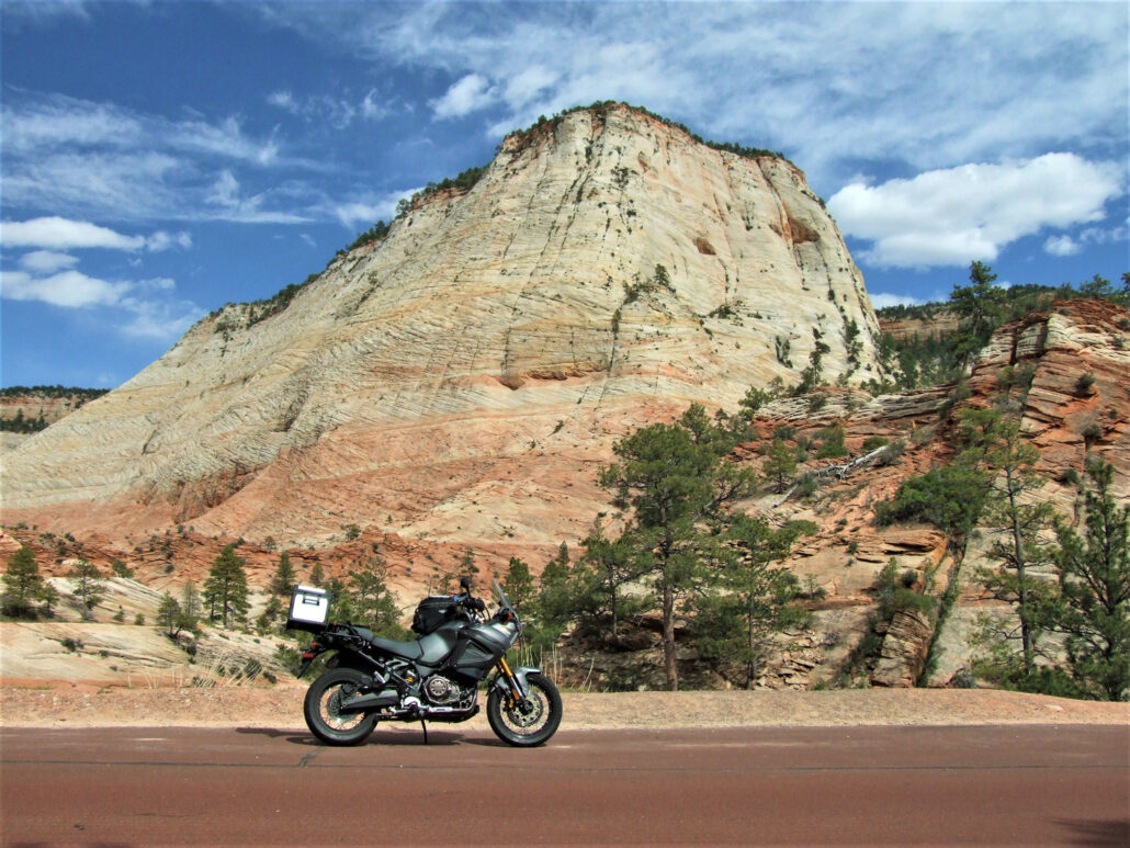
Zion National Park
By Douglas Weir
My definition of an “end-to-end” ride is a trip on an old, two-lane, U.S. numbered highway that is at least 500 miles long.
If you have access to the American Motorcyclist of March 2016 (members can read it online at www.americanmotorcyclist.com), I provided a table of most of the U.S. highways that met that criteria and some of the challenges an end-to-end ride might entail. I also covered my first end-to-end ride, which was U.S. 14 from Chicago to Yellowstone National Park.
Next, I did one of the Grand Daddy’s of them all: U.S. 2 from Everett, Wash., to Houlton, Maine. It was covered in the American Motorcyclist March 2017 issue.
This story is about my third end-to-end: U.S. 89.
My reasons for choosing the 1,700-mile U.S. 89 were simple: I live a few hundred miles from it; it passes by or through many of the major western national parks; and it has some good motorcycle riding.
Before you attempt to replicate my ride or any other, keep the following in mind, especially a north-to-south version.
Alignment
Alignment, or the exact path U.S. highways can take, may change over time. The beginning or end can be moved or, in the case of U.S. 66, the entire roadway can be almost obliterated by succeeding interstates.
Fortunately, I have a 1940 road atlas, which I used to look at the old alignments of the U.S. highways. When I refer to the term “historic,” I am talking about how things were before WWII. If you don’t have a similar source, you can buy a booklet with maps for U.S. 89 showing both the historic and current alignments from the 89 Appreciation Society.
The northern terminus of U.S. 89, near Glacier National Park, has not changed. That is not true in Arizona. Historic U.S. 89 ended at the Mexican border town of Nogales. The current route ends where I-17 begins in Flagstaff, Ariz.
However, the state has taken over the alignments for both historic 89 and 89A, and since I wanted to ride the excellent roads around the ghost town of Jerome, I decided to ride as far as Wickenburg, Ariz.
Altitude and Latitude
For a U.S. 89 ride, there are significant changes in altitude and latitude. It is almost 1,000 air, not road, miles from north to south. Elevation ranges are from about 2,000 feet to 10,000 feet. These two extremes could result in a 60-degree or more spread in temperatures.
On the way south, we experienced a low of 40 and a high of 101 degrees. Be prepared!
- Capitol Reef National Park
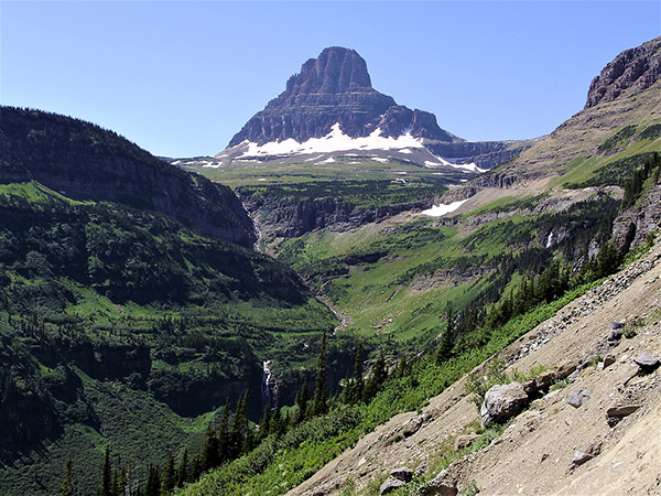
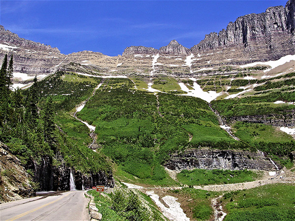
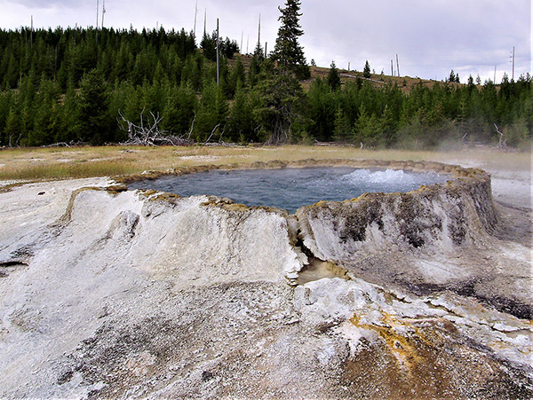
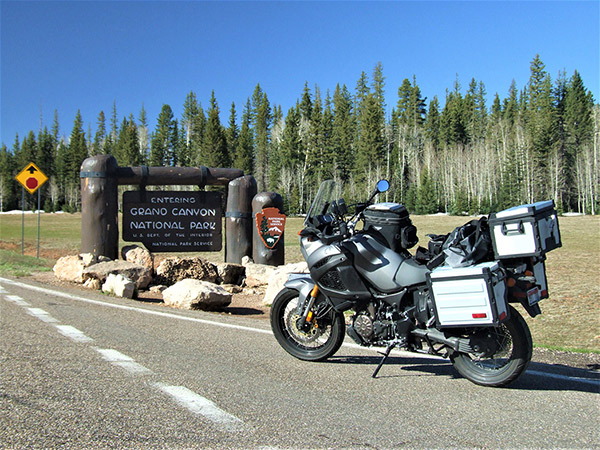
Clockwise from top left: Reynolds Mountain in Glacier National Park, the Weeping Wall in Glacier National Park, the entrance to the North Rim at Grand Canyon National Park, and Punch Bowl Springs at Yellowstone National Park.
Practicality
Don’t be a slave to the task of riding every inch of the designated road. This is supposed to be a fun motorcycle ride!
Many historic U.S. highways went right through the middle of cities. This could be both a hassle and a dangerous situation.
If there is a better road running parallel to the designated road, Take it!
National park strategy
Since a big part of the attraction of a U.S. 89 ride is the more than half-dozen National Parks you will pass through or near, you need a strategy to visit them.
I cannot stress enough that the parks are getting ever more crowded. So, if you plan to travel during the prime season of mid-June to mid-September and want to stay indoors near or in the parks, you must have confirmed reservations.
Getting these reservations could take one to two years. You also might carry minimalist camping gear, just in case.
Our plan south
Since it is almost impossible, because of temperature swings and snow, to do U.S. 89 in one shot, my riding buddy, Jim Metzger (BMW R1200) and I decided to start the southern three quarters of the ride at the small town of Alpine, Wyo., on the first weekend of June.
Alpine has all the services needed and is far enough away from Grand Teton National Park to have reasonable prices.
From there, we would head south and briefly hit the major national parks along the way, ending up at our southern terminus of Wickenburg, Ariz.
From there, we would head northeast to U.S. 191 North, another good road. This would allow us to go through the high elevations of Yellowstone National Park in the second week of June when most of the park is usually open.
We would then ride to mid-Montana and head home. We would finish the rest of the ride north in July, when Glacier National Park is usually fully open.
It was cold in Wyoming riding south of Alpine, but the road was fun. We passed by beautiful Bear Lake near Montpelier, Idaho, and it was four lanes to I-15 near Brigham City, Utah.
We bypassed Salt Lake City on I-15 (you should too) and headed for Salina, Utah. However, we ran into the head wall of a thunderstorm, so we stopped short in the little town of Gunnison, Utah.
The next day, we hit the great route of Utah 12 to Capitol Reef and Bryce Canyon national parks, then Cedar Breaks National Park, and found a place to stay on at Mount Carmel Junction.
We rode into Zion National Park about 5 p.m. Note: You don’t want to go into Zion between 10 a.m. and 4 p.m, because it can be hot and very crowded. There is a one-way tunnel on Utah 9, and the wait for your turn can be very long in the sun.
Plus, if you want to visit the Virgin River Canyon, you must take a shuttle bus.
Heading south on U.S. 89A the next morning, we decided at the last minute to hit the North Rim of Grand Canyon National Park.
Arizona 67 is a very nice entry road, especially if you like sweepers. The views from the rim were spectacular!
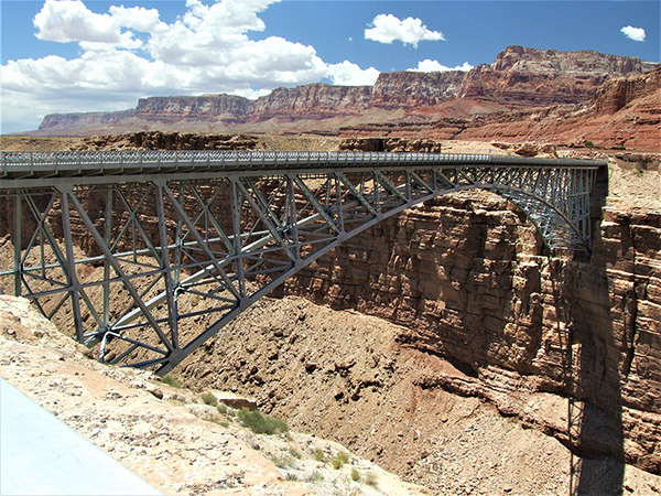
We then crossed the Colorado River on U.S. 89A on the Navajo Bridge near Marble Canyon, Ariz. It was hot! We had stripped down to our outer mesh jackets.
We spent the night in Flagstaff, Ariz., where the current U.S. 89 now ends. But we wanted more.
We took Arizona 89A to Sedona, Ariz. Nice curves, but the pavement was in awful shape. Then, up to the semi-ghost town of Jerome. Great road and history.
Past Jerome, we took Arizona 89 to Wickenburg, Ariz. Along the way, there was a stretch of road that was one-way south with passing lanes. Great fun, but we wondered why it was built.
It was 101 degrees in Wickenburg, and the forecast for the next week was 109. Glad we didn’t wait a week.
After a nice, much cooler ride through northern Arizona’s Coconino National Forest, we stayed in Holbrook, Ariz., then rode through the Petrified Forest National Park and picked up U.S. 191. Note: There is a lot of U.S. 66 memorabilia near Holbrook.
As we headed north, I was worried that there would not be services across the vast Navajo Reservation, but I was wrong. There were plenty.
Farther up U.S. 191, since we both had visited Utah’s Canyon Lands and Arches national parks often, we decided to skip them. However, we did take the 20-mile detour on Utah 211 to the Canyon Lands National Park Needles Overlook of the Colorado River Canyon. What an incredible view!
U.S. 191 swings way to the west, north of Moab, Utah, so we decided to go east to stay in Fruita, Colo. Unfortunately, Utah 128, a great scenic and motorcycle road, was closed, so we had to go the long way around via I-70.
The next day we took Colorado 139 north. It had some very nice curves, but again, the pavement was very poor. As we approached the low Douglas Pass on Colorado 139, the temperature started dropping much more than we expected. On came all the riding clothes.
Then, it got much warmer as we descended to the Green River and Dinosaur National Monument. So, off came the clothes.
From Dinosaur National Monument, we got back to U.S. 191 at Vernal, Utah, and some more road fun started.
U.S. 191 north of Vernal has some great switchbacks with even passing lanes as it climbs. But the temperature started to drop again. When we got to Rock Springs, Wyo., our fun was over. The temperature was 40 degrees and falling, and it was starting to snow.
So, we gave up on going north to Yellowstone National Park and retreated west back to Idaho. This was a good thing, because on the next day’s morning news, we saw that 6 to 12 inches of snow had fallen around Yellowstone National Park, and the temperature was in the 20s.
We had to wait in Montpelier, Idaho, until 10 a.m. for the temperature to rise to 40 degrees. We droned back to northern Idaho on the super slabs.
We did 3,600 miles in nine days. The northern part of U.S. 89 had to wait.
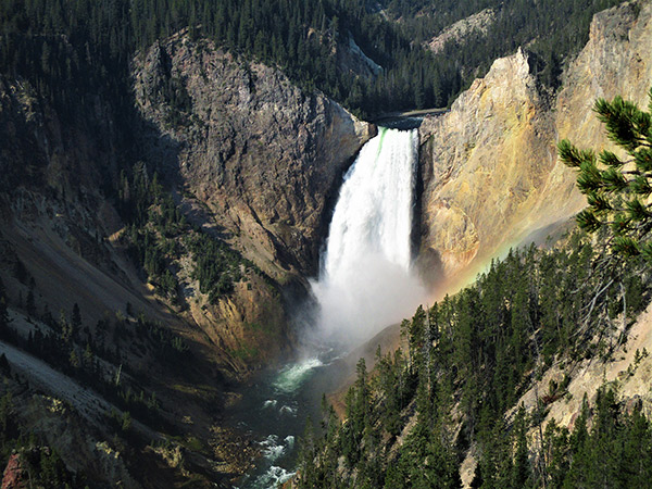
- Lower Falls at Yellowstone National Park
- Navajo Bridge
- Capitol Reef National Park
Our plan north
We planned to ride back to Alpine, Wyo., in early July. By then, the temperature spread should be more favorable to riding—50 to 90 degrees.
We would head north through Grand Teton and Yellowstone national parks to Livingston, Mont. Next, from there to Browning, Mont.—the end of U.S. 89 at the border with Canada—cross through Glacier National Park, and then ride the 250 miles back to northern Idaho.
Since we both have visited Grand Teton and Yellowstone national parks often, we just cruised these parks with a few stops.
We spent the night in the railroad town of Livingston, Mont. Next, we rode U.S. 89 through the Little Belt Mountains (nice sweepers) and then to Great Falls, Mont., where we visited the Lewis and Clark Interpretive Center.
It is only a few miles off U.S. 89 and led us to a beltway, which followed the Missouri River around the city center.
Then on to Browning, Mont., which has the Museum of the Plains Indian and a large casino (great food).
From there, we rode to the end of U.S. 89 at the Canadian border.
This location also is on the Blackfeet Reservation, where there is an Indian art exhibit at the Canadian border.
The entrance to Glacier National Park is a just few miles back south. After taking the “Going to the Sun Highway” in Glacier, we rode back to northern Idaho.
If you need to get back to U.S. 89, U.S. 2 is much faster. A few miles east of Essex, Mont., don’t miss the Goat Lick observation point.
Summary
Should U.S. 89 be on every rider’s bucket list? Absolutely! The combination of good riding and the scenery of the National Parks is unbeatable.
Can it be done in a single ride? Maybe?
My recommended plan would be to start at the Canadian border in late September with the objective of being through Yellowstone National Park by Oct. 1. After that date, snow in the higher elevations becomes ever more likely.
If you took another week or two to hit Wickenburg, Ariz., the local high temperature would then be only about 90, which is much better than the 100-plus readings during mid-summer.
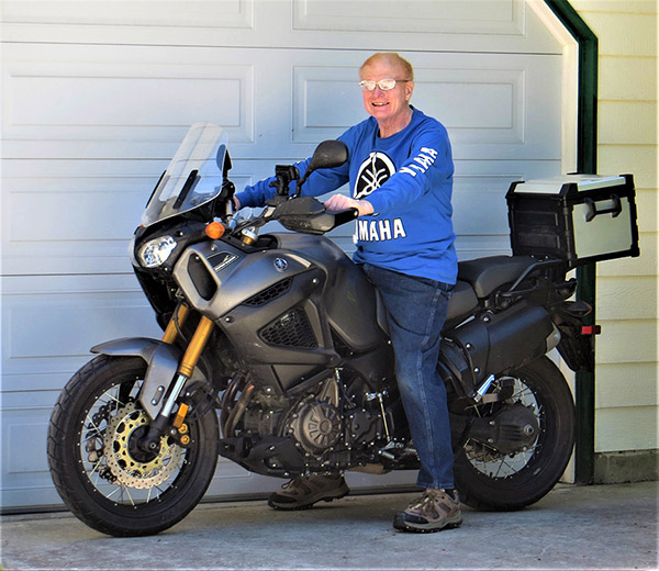
I would like to put in a plug for my faithful mount, my Yamaha Super Ténéré. The ergonomics and seat make 400-mile days a pleasure. The motor is a torque monster. But the best part was the suspension, which sucked up the bad pavement we encountered like it wasn’t even there.
Douglas Weir is an AMA Charter Life Member from Hayden, Idaho.

