AMERICAN MOTORCYCLIST July 2019
Seldom seen sites
Exploring Geological, Historical Places
By Tom Culbertson
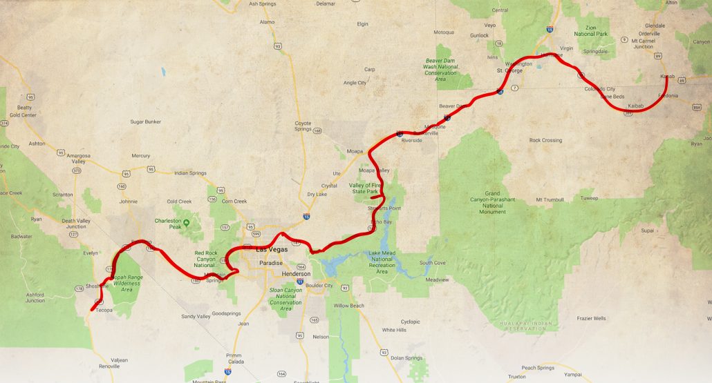
Thinking about Las Vegas, people have visions of gambling, stage shows, eating and Lake Mead water sports. However, there are several geological and a couple historic locations nearby that are seldom visited. These are within a 170-mile radius of Las Vegas.
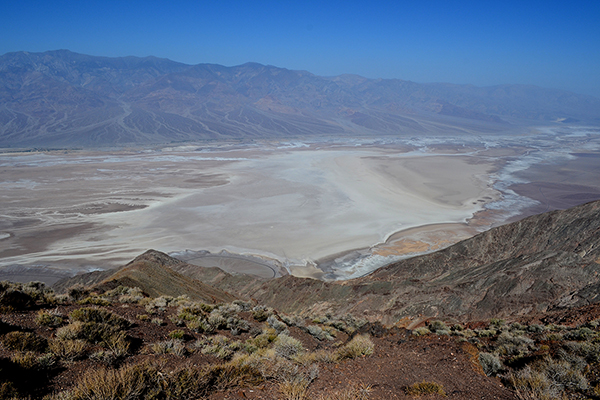
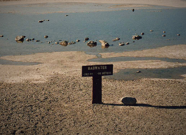
The landscape, as seen from Dante’s View, 5,476 feet above Death Valley. Right: Badwater, lowest point in continental United States.
You could spend three to five days exploring them all. Or, spend several days absorbing each place.
Renting a bike in Vegas is a great way to check them out.
My friend Andy and I started from Mojave, Calif., where the west wind was so strong I had difficulty keeping the bike vertical. At Mojave, there was no electric power—and no breakfast. After a granola bar, we started east for Trona, with the wind at our backs.
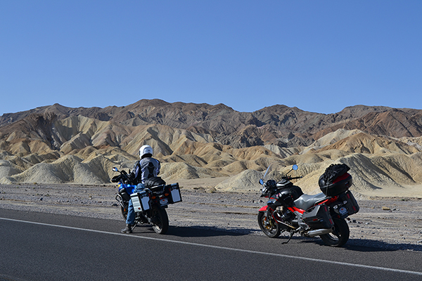
Out here, it’s arid desert landscape with mostly straight roadways. Just cruising. No corner carving. Easy riding.
Half way to Panamint Springs, I heard a tremendous roar, and suddenly there was a fighter jet blasting up the valley at just 500 feet. What a sight!
 Into Death Valley National Park, the largest national park south of Alaska, we rode toward Wildrose Canyon and Charcoal Kilns. We enjoyed a few miles of gentle curves, but the last miles to the kilns are unpaved, terribly rough, rutty and rocky. It was a little scary.
Ten kilns loomed before us. Completed in 1877, they are 25 feet tall and around 32 feet in diameter. Only used two years, they are in excellent condition today.
Retracing, we cruised on straight blacktop to Furnace Springs Ranch Bungalows for the night. These bungalows, originally used at Hoover Dam for construction workers, were moved here in 1930. After checking in, we motored south to Badwater, the lowest location in continental United States at 282 feet below sea level. The lowest spot is several miles to the northwest. Reversing course, we scooted back to our historic lodging.
Come morning, we were loaded and rolling. Our first stop was Dante’s View at 5,476 feet over Death Valley. For 15 miles, we cruised great blacktop and swayed through gentle curves. The last stretch is a very narrow, windy, blacktop single lane. Not even room for two cars.
Reaching the top, the view was breathtaking: Devil’s Golf Course, Badwater Basin, Telescope Peak (11,047 feet), and much more.
Mounted up with fingers crossed that no motorhomes are on the narrow, windy road, we departed Dante’s View. At California Hwy. 190, we sat back and cruised over straight pavement all the way to Pahrump, Nev., and gas.
Our next stop was Red Rock National Conservation Area, about 20 miles west of Las Vegas. Red Rock has a scenic loop that displays the white-and-red Aztec sandstone, as well as limestone deposits from an ancient ocean sea bed. To the west is the Keystone Thrust Fault, where the oceanic plate began moving beneath the western edge of the North American Plate. It’s unique, because the rock layers are reversed, where younger sandstone is capped by ancient limestone.
Heading onward, we struggled through the Vegas traffic to take I-15 north. Exiting for back roads to North Shore Road by Lake Mead, we arrived at Valley of Fire State Park.
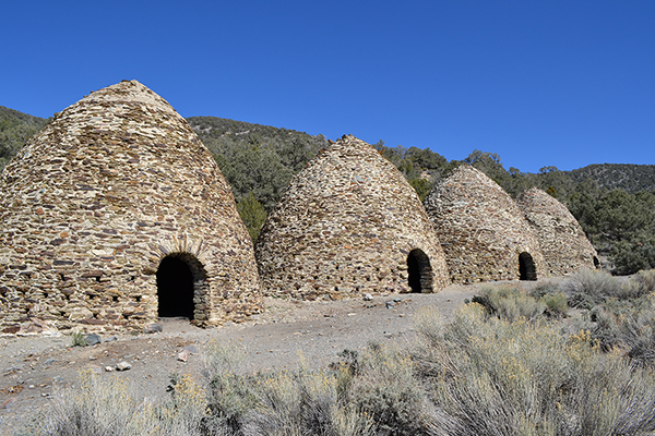
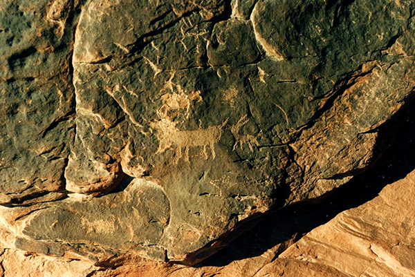
The Wildrose Charcoal Kilns were completed 1877 and shut down after two years. They look new and are 25 feet tall and 32 feet in diameter. Below: If you like petroglyphs, Valley of Fire has them throughout the park.
The name Valley of Fire was chosen because at certain times the Red Sandstone appears on fire, reflecting the sun’s rays. There are numerous eroded boulders with strange giant faces and bodies. Also, several remarkable petroglyph sites can be viewed. With the late afternoon approaching, we rode up to I-15 and spent the night it Mesquite, Nev.
The next morning, we enjoyed I-15’s curvy pleasures through the Virgin River gorge. After diving from curve to curve, we returned to sedate cruising, looking for the Hurricane exit. Just after Hurricane, Utah, we caught Utah 59, taking us right into Arizona, where the road becomes Arizona 389.
About 30 miles of arid desert scenery precedes the entrance to Pipe Spring National Monument. Inhabited by Puebloans and Paiute Native Americans for close to 1,000 years, the Spring was “discovered” by Spanish explorer Antonio Armijo in 1829. After being raided during the Black Hawk War, a fort was built over the spring in 1872.
Saddled up, we motored back to Kanab, Utah, and Coral Pink Sand Dunes State Park.
At first viewing, this area appears to be just a sand box contained by cliffs of Navajo Sandstone. But the geological story is worth the visit.
The Sevier fault cuts the length of the park and is marked by a west-facing escarpment dividing the park into two units. This was created by the impact of Basin and Range province to the west and Colorado plateau to the east.
The sand color is derived from iron oxide. Look closely, and you will notice several dune types across the area.
There is much more to learn about this area’s geology, which provides an excellent reason to return.
Limited by Andy’s vacation time, we turned around and cruised over straight, two-lane asphalt to spend the last night in St. George, Utah. Come morning, we charged south on I-15 for the ride home.
Tom Culbertson is an AMA Charter Life Member from Port Hueneme, Calif.
